Another great day for a drive!
Sunday, November 27, 2005
“For those who aren’t into ‘roughing it,’ RVing is the way to go. RVers find the ultimate combination of miles of uncrowded highways, spectacular scenery, endless outdoor adventure, RV parks with all the amenities and statewide 24-hour dining and entertainment,” says the official Nevada state map.
I’ve been learning a lot about Nevada, The Silver State. Did you know that 87 percent of it is public lands? The state has ten scenic byways – one of which is the Las Vegas Strip.
Here’s more Nevada info:
--Nevada means snow-capped in Spanish
--Besides The Silver State, another nickname is “Battle Born State.”
--The state bird is the Mountain Bluebird, the state animal is the Desert Bighorn Sheep
--There are five “living” ghost towns: Belmont, Berlin, Rhyolite, Tuscarora and Unionville.
Highway 95 – a.k.a. Veterans Memorial Highway – was my road today, and my planned stop for the night was Beatty and the Burro Inn RV Park. The two-lane highway is mostly flat with spurts of traffic including 18-wheelers and other RVs. The road seems to be paralleling a dry lake. Jeremiah was on cruise control most of today’s drive. My odometer passed 2,000 miles for this trip! Speed limit is 70, Jeremiah (and I) prefer 55 to 60!
I went through several very small towns. As I slowed down for Luning a sign said:
“No vehicle containing explosive devices may park in the town of Luning.”
It’s a beautiful day for driving; blue sky and no wind.
As I was entering the tiny mining town of Mina, I could see a lot of water on the highway and also flashing emergency lights. As I passed by I could see that one of the small wooden homes had burned down and was still smoldering. The volunteer fire department must have responded really fast because this house was flanked by other small wooden homes that appeared to be untouched by fire. The town is mostly wood structures, and many of those look abandoned.
Coaldale, Tonopah and Goldfield are the next dots on the map. Nothing remarkable about any of them. This part of the highway parallels Nellis Air Force Range.
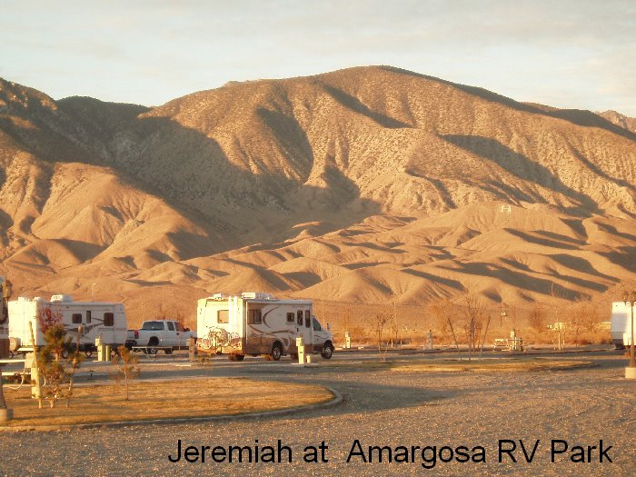
The small town of Beatty consisted of just a few streets. The first RV park I came to was less than wonderful, so I continued on to Burro Inn which despite the write up in my RV Directory was deserted. Thankful for being a flexible person (well, most of the time), I continued south, past more “ranches” and a couple tiny map dots, until I came to Amargosa Valley and the Amargosa RV Park.
Enough driving for the day. The park is OK for the night. I’m at 2,350 feet elevation; a big change from the past few weeks. Tomorrow I’ll drive 50 miles to Pahrump to explore the area and spend the night at Terrible's Lakeside RV Park!
posted by Carol A. Anderson @ 3:19 PM
![]()

<< Home